The Svalbardfiberen incident

Reconstructing the 2022 Svalbard subsea cable failure

Adventfjord
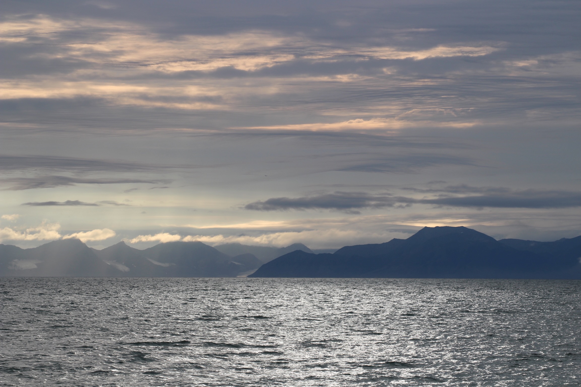
Adventfjord, Svalbard. Photo: Alex Garrison, 2024. CC BY 4.0.

Introduction

The Arctic archipelago of Svalbard is connected to the Internet by just two subsea cables, which run to mainland Norway. Through them flows the downlink data from the Svalbard Satellite Station (SvalSat), scientific data from the research outpost of Ny-Ålesund, and data from the settlements of Longyearbyen and Barentsburg. Its remote location poses a challenge for communication, but also an opportunity to download data from satellites in polar orbits1. It is therefore concerning that at 04:10 Central European Time on 7 January 2022, one of the cables lost signal [1, p. 1] [2, p. 141]. A loss of redundancy to this connection is a serious resilience risk to both Svalbard's 2914 inhabitants and the governments and space agencies that rely on SvalSat's continual stream of downloaded mission data [3]. In January 2022, the only reserve was a satellite connection limited to 2 Mb/s [4].

An investigation into the cause of the damage was opened by the Troms police department [5]. This included inspection of the seabed near the cable via a remotely operated vehicle (ROV)2 as well as questioning of the skipper and navigator of the trawler Melkart-5, which had been operating in the area surrounding the cables at the time of damage [6]. Despite finding indications that human activity was the cause of the damage, the investigation was closed due to insufficient evidence [7] [8]. Media reporting drew attention to the Melkart-5's trawling directly over the cables, totalling 30 crossings in the two days prior [9]. However, this evidence remains circumstantial, as the frequency of the crossings does not, by itself, establish causation.
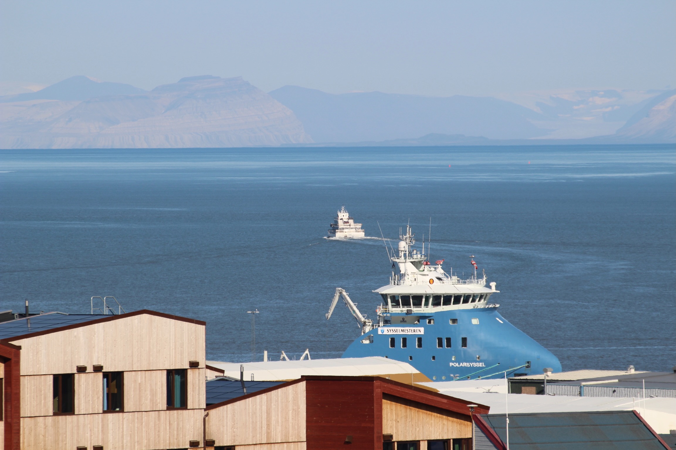
The Polarsyssel moored in Longyearbyen harbour with low clouds over the surrounding mountains.
Figure 1 Polarsyssel in Longyearbyen harbour. The ROV used to inspect the cable was launched from the vessel [7]. Photo: Alex Garrison, 2024. CC BY 4.0.

Since the investigation concluded, the incident has been generally treated in the security studies literature as unresolved and unattributed. As recently as January 2026, a dataset of Russian operations3 specifically excludes the Svalbard incident as the investigation did not prove who was responsible [10].

To improve upon this past analysis, this article seeks to reconstruct the incident from public data and determine if the Melkart-5 was indeed the cause of the damage. However, it does not seek to assess whether any interaction was intentional, or if it was suspicious. A description of the methodology used within this paper is outlined in a Technical Appendix.

This reconstruction supports Melkart-5 as the best available explanation for the damage: the fault began during the same minute in which its trawl gear plausibly crossed the affected cable; the recovered cable exhibited mechanical damage consistent with a trawl gear overrun; and there was no other observed vessel in the area at the time of failure. It also raises important questions about the security and resilience of these subsea cables, as it contradicts the assumption that they were protected against this form of damage.

The cable

The Svalbard Undersea Cable System (Norwegian: Svalbardfiberen) is comprised of two SubCom SL21 fibre-optic cables, which run from Longyearbyen4 to Harstad via Breivika on the mainland [11] [2, p. 143]. These are referred to as cable A (western) and cable B (eastern), shown in the map.

The 156 km stretch of cable in which the damage occurred is described by an article on the cable's implementation as being SA (single armoured), and buried [2, fig. 10]. This form of protection was intended for heavily trawled areas [2, tbl. 1].

Cable A
Cable B
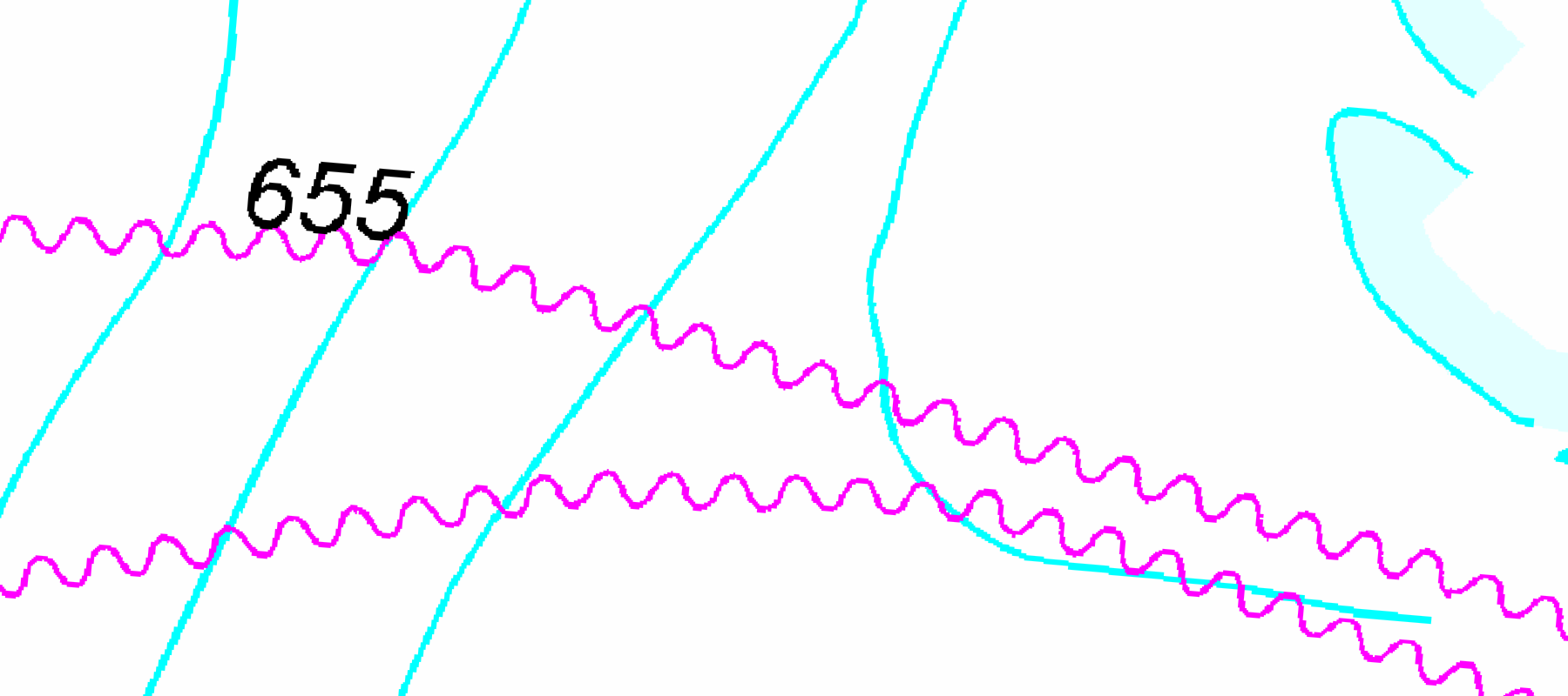
Figure 2 The two Svalbard fibre routes approaching Longyearbyen. Cable A is the affected cable used in the reconstruction. Cable types: [2, fig. 10]. Land: Natural Earth. Depth contours derived from GEBCO 2026 [12].

The trawler

The Melkart-5 was built in 1996 at a Norwegian shipyard, and was operated by Norwegian fishing companies until May 2018, when it was sold to Murman Seafood, a Murmansk-based fishing company5 [13] [14].
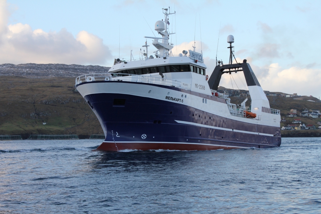
Figure 3The Melkart-5. Photo: Murman SeaFood Co. Ltd

Trawl gear

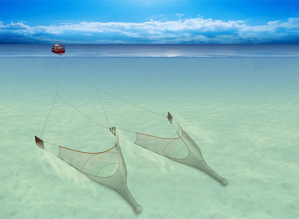
Figure 4Trawl diagram. Photo: Seafish.

Trawlers operate by towing either a single net (single-rig) or multiple nets (twin/multi-rig). The net mouths are held open hydrodynamically by trawl doors and weighted along their lower edges by ground gear. In twin-rig trawling, a clump weight can link the two nets at the centre. The doors and clump are connected to the trawler by adjustable warp lines. Trawl gear can target fish on the seabed (demersal), slightly above it (semi-pelagic) or in midwater (pelagic). Only during demersal trawling does the trawl gear makes contact with the seabed.
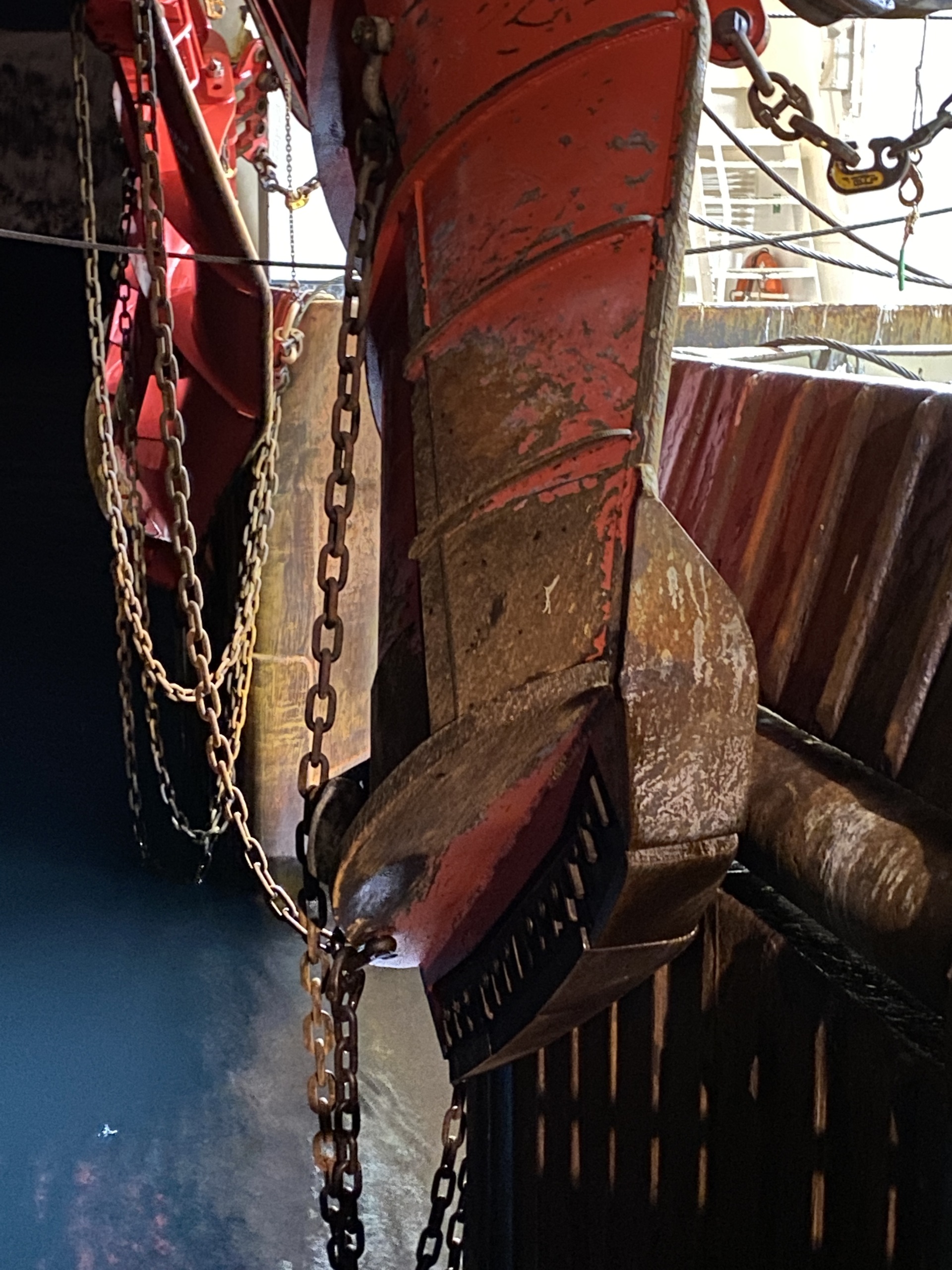
Figure 5Melkart-5's trawl doors in Båtsfjord in January 2022.
Photo: Norwegian Police / Skyggekrigen [15].

The Melkart-5's trawl gear manufacturer describes the vessel as using 12 m2 Super Shark trawl doors and a 6,800 kg roller clump [16] [17].

A photograph taken aboard the Melkart-5 in Båtsfjord on 13 January 2022, is visually consistent with that trawl door design [15]. The use of the clump weight suggests a twin-rig configuration, with the trawl doors being intended for either demersal or semi-pelagic fishing [16].

Additionally, the Norwegian Electronic Reporting System (ERS)6 catch reports for the selected area and period contain 166 bottom-otter-trawl rows, of which 158 specify a twin-rig configuration [18]. Atlantic cod accounts for 152 rows, haddock for 8, and northern shrimp for 6. Cod and haddock are targeted via bottom trawling7. This supports twin-rig bottom trawling as the most likely configuration.

Modelling the trawler

Within my reconstruction, the trawler's position is determined by its broadcast Automatic Identification System (AIS) messages. After the positions are checked for errors, a smooth line is fitted through them to represent the vessel’s path. The trawl gear towing point is placed behind the AIS antenna.

The model estimates the paths of three parts of a twin-rig trawl: the port door, the starboard door, and the centre clump. Two values control their positions:

Parameter Explanation
Door spread The distance between the two trawl doors
Warp-to-depth ratio A value that uses the water depth to estimate the warp length and how far the gear trails behind the vessel.

The model tests 85 combinations of these values. The parameter grid is a sensitivity analysis: it tests whether the result persists across a range of parameters rather than assigning probabilities to individual configurations. For each valid combination, it calculates the gear positions at 1-second intervals from 03:05:00 to 03:15:00 UTC, according to the following steps:

  1. Calculate how far the gear trails behind the towing point.
  2. Place the centre clump behind the vessel and the two doors on either side.
  3. Check whether the path of any component crosses cable A during the failure minute.

The incident

Space Norway reported the failure at 04:10 CET, equivalent to the UTC minute beginning at 03:10. Because the public timestamp has only minute precision, this analysis represents the failure interval as [03:10:00, 03:11:00) rather than assuming that the failure occurred at exactly 03:10:00.

Vessel Doors Clump Cable A Crossing
03:05:00 UTC
reported failure minute
loading data…
Model inputs
Figure 6 Interactive replay of Melkart-5, its trawl gear and cable A. Depth contours derived from GEBCO 2026 [12].

During that minute, 15 of the 85 tested scenarios produced at least one crossing of cable A. Of the 15 trawl gear crossings, 9 were port door and 6 starboard door.

Incident location

When the cable was repaired in June 2023, a Notice to Mariners (Norwegian: Etterretninger for sjøfarende; EFS) was issued by the Norwegian Mapping Authority [19, notice 71611]. This identified the cable repair ship as the Cable Vigilance, which repaired the cable by recovering the damaged section and splicing in a new one [20]. The location of the Melkart-5's intersection with the cable lies directly on the damaged section.

Figure 7 The modelled incident centroid, 2023 EFS notice track and Cable Vigilance track overlaid on the affected cable. Select Overview for the Figure 2 map extent; toggle the legend entries to compare layers. Cable types: [2, fig. 10]. Land: Natural Earth. Depth contours derived from GEBCO 2026 [12]. Sea Chart: Kartverket [21].

Cable damage

Space Norway described the cable damage as a shunt fault [22]. This means the actual fibres of the cable were undamaged: the polyethylene insulation surrounding the copper sheath was damaged, causing a short circuit with the seawater. However, in order for this insulation to be damaged, the cable armour (16 tar-covered wires) would deform to open a gap. The tar-soaked nylon yarn encasing the cable would also have to be stripped [2, p. 143]. The photographs of the retrieved damaged cable clearly correspond with this damage profile [20] as the outer yarn is completely stripped and the armour wires have been crushed.

This form of damage likely corresponds with heavy objects being dragged over the cable, such as the trawl gear. Additionally, the nearby seabed exhibited marks consistent with trawl doors [23]. Any one of the trawl gear components could have overrun the cable, compressing it against either the hard glacial till or a boulder. Anchor damage is also possible, but an unnamed expert cited by NRK claimed there are "no signs" of the characteristic hooking exhibited by anchor damage [20].
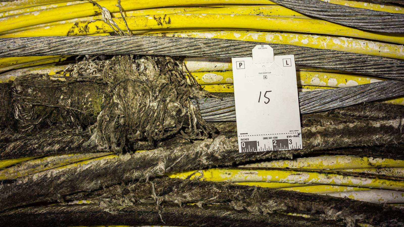
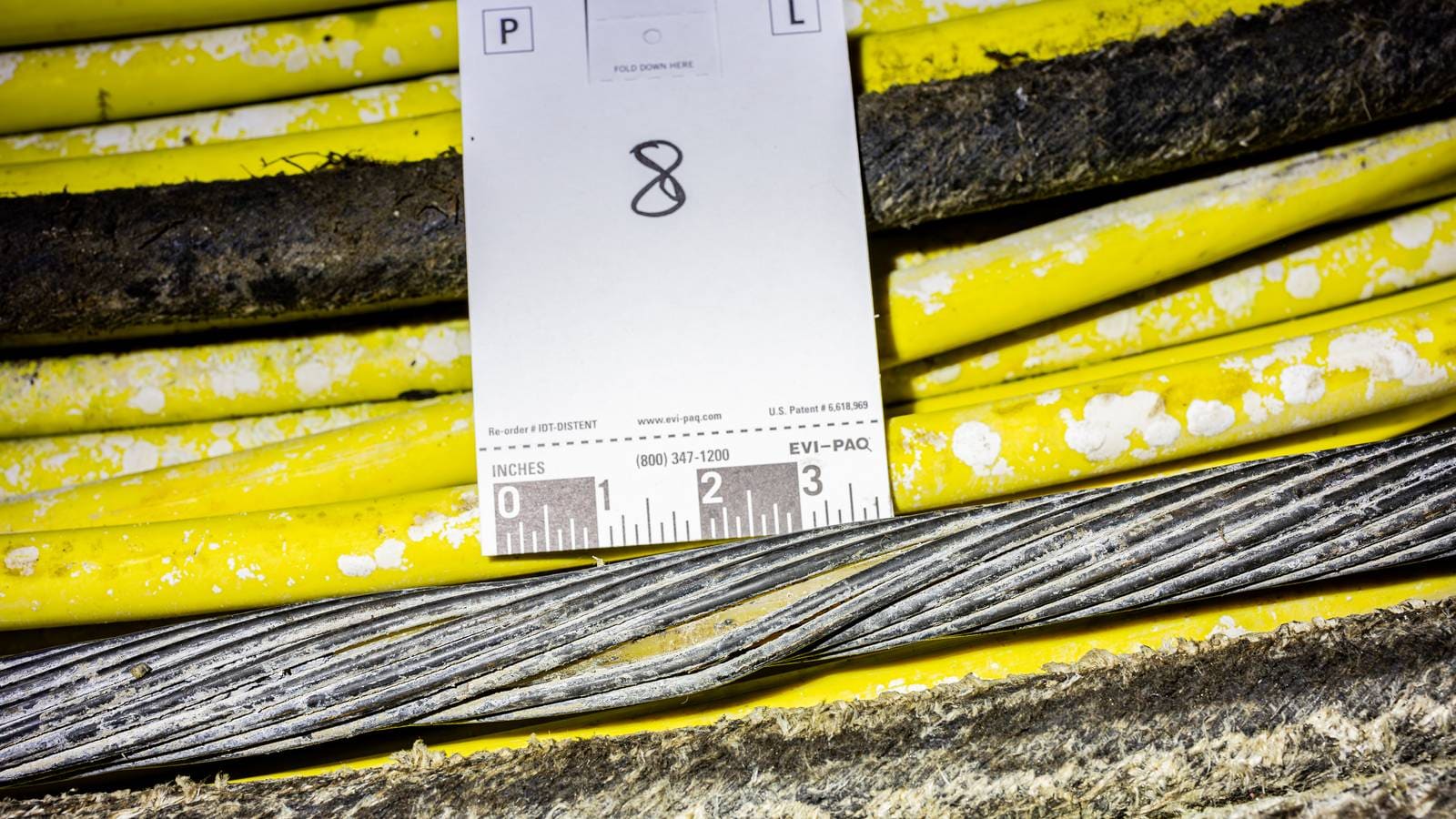
Figure 8The recovered Svalbard fibre cable. Photo: Norwegian Police / NRK [20].

Alternative explanations

A variety of other explanations for the cable damage can be suggested but none explain the relevant features of this incident as well as the Melkart-5 hypothesis.

One of these alternative explanations is that the damage was caused by another trawler. Another Russian trawler, the Yagry also trawled over the affected region of cable. However, its cable intersections began 12 hours after the cable failure was reported. It is also possible that another vessel could have caused the damage but disabled its AIS transponder, meaning that it cannot be detected conventionally.

HypothesisExternal damageFailure timingCable locationMain uncertainty
Internal failure*NoYesYesDoes not explain the photographed mechanical damage.
Sediment movementUnlikelyUnlikelyPossibleNo contemporaneous movement has been identified publicly.
Earlier fishing damage with delayed ingress*YesPossiblePossibleThe sequence and delay cannot be reconstructed.
Another trawler*YesNoNoNo other observed vessel's trawl gear crossed the repaired location at the time of failure.
Melkart-5's anchorPossibleYesYesCable damage does not exhibit signs characteristic of anchor damage.
Melkart-5's trawl gear*YesYesYesHorizontal crossing is modelled; accessibility, vertical contact and force are not able to be accurately modelled.
Rows marked with an asterisk (*) represent hypotheses that were considered by Troms Police District during its investigation [8].

Cable accessibility

In order for the cable to have sustained damage of this kind, it must have been physically accessible to the component which damaged it. The cable is described as being buried at an average of 2 m [2, p. 141]. This would be suitable to protect a cable from trawl doors, as they can only penetrate up to 35 cm in soft sediment [24, tbl. 6]. The roller clump would penetrate far less than that, as it is designed to roll along the seabed. This presents an apparent contradiction between the reported average burial depth, which would have protected the cable, and the fact of the damage.

However, the reported burial depth is an average over 172 km of cable, not a guarantee that the cable was buried at that depth uniformly [2, p. 141]. At the point it was damaged, the cable may not have originally been buried at a safe depth (explanation 1), it may have become uncovered since it was laid (explanation 2), or a combination of both.

Explanation 1

The burial depth of a subsea cable on Forlandsbanken depends on the depths of the softer silt layer, as the glacial till below is far more difficult to be ploughed by the lay vessel [25, p. 5]. A seabed core 19 km away from the candidate location contained about 1.65 m of softer mud before reaching till [26]. However, it is possible that boulders or more rocky sediment could have prevented the plough from functioning as intended. When this happens ROVs with water jets can be used to bury the cable, but the article gives no indication that this technique was used [2].

There is the possibility of a mechanical issue during the cable laying. A NOAA Environmental Assessment of two Pacific Crossing-1 subsea fibre cables off Washington State found that the intended burial depth target was often not met, even leaving some cable exposed at shallow depths for large stretches of the cable. This was due to factors such as high cable tension, excessive ploughing speed and rough seas when laying [27, pp. iv, 40, 59]. However, the technical details of the cable laying are not publicly available, so it is unknown if the factors that affected the Pacific Crossing-1's burial also affected the Svalbard Undersea Cable System.

Explanation 2

There are also potential mechanisms by which the cable could have become progressively more exposed.

Process Explanation Evidence
Erosion via a strong bottom current Near-bed currents could progressively scour sediment from above the cable. Sediment core evidence from the south-west Spitsbergen shelf shows that regional near-bed currents transport seabed sediment [28, p. 767].

However, no site-specific measurements are available.
Submarine landslide A small landslide could displace sediment. Past seabed movement has been documented near Isfjordrenna [29, p. 5]. GEBCO estimates a 4° slope at the modelled crossing centroid [12], but this does not establish that a landslide occurred at the cable.
Sediment disturbance by trawling activity Repeated trawl gear passes could furrow and displace sediment. Global Fishing Watch reports 71.5 hours of trawling activity in a 2 km radius of the incident location, between 2012 and the reported failure time [30].

These processes are overlapping, and compounded by a potentially shallow burial, there is a plausible mechanism by which the cable could have been physically accessible.

The exact mechanics of how the cable came to be vulnerable to trawler damage remain undetermined. However, the observed damage implies that the cable must have been accessible at the failure location. This is contrary to the assumption given by the report that the cable was sufficiently armoured and buried as it failed under the circumstances it was specifically prepared to withstand [2]. It is likely that there is more detailed information on the laying of the cables, but it is understandably not in the public domain.

Conclusion

The purpose of this reconstruction was to establish if the existing evidence for the role of the Melkart-5 in the incident could be improved upon. It is deliberately limited in scope, and factors such as intention and suspiciousness are not provable from the data alone. However, the model does clearly establish that the Melkart-5's trawl gear likely crossed the cable at the time of its failure. This finding is supported by the morphology of the cable damage and the location of the cable repair.

The International Cable Protection Committee estimates between 105–160 human-caused faults per year, so incidents like this are not uncommon. However, Svalbard is both uniquely important and uniquely vulnerable in ways that other places are not. It does not benefit from the redundancy and interconnectivity enjoyed by other regions, which makes Svalbard's need for secure and resilient infrastructure paramount.

Regardless of the intent of the Melkart-5 in its trawling over the cable, the incident exposed a major failing: the protection of the vital cable was insufficient despite deliberate steps taken to insulate it from trawling damage. The problem of ensuring adequate cable protection over 1375 km of cable is not trivial, but the cost of a disconnected Svalbard is too high to put aside [2, p. 141]. The importance of this vulnerability has been intensified by recently reported covert Russian operations. In the spring of 2026, Russian submarines8 were discovered to be training for the deployment of an unspecified "secret weapon" on the Svalbard Undersea Cable System [31]. The submarines were tracked and eventually deterred by a joint British, Norwegian and U.S. effort, but they remain continually exposed to damage.

The Norwegian government announced the Arctic Way Cable System (AWCS) in February 2025 [32]. This new cable system will join Jan Mayen, another remote Arctic archipelago, and Svalbard with Bodø in mainland Norway, entering service in 2028 as the current system reaches the end of its technical lifetime [33, p. 8]. However, a new cable alone does not ensure Svalbard's information security. The failure to protect the current cable system must inform the design and deployment of the AWCS, or it will be just as vulnerable as before.


  1. SvalSat is critical for functions such as weather forecasting and climate monitoring, as well as maritime surveillance [34]. ↩︎

  2. The ROV was unable to locate the cable on the seabed [8]. ↩︎

  3. The dataset has been cited by academic articles on cable protection [35, p. 2] as well as the International Institute for Strategic Studies [36, p. 4] and the U.S. Congressional Research Service [37] ↩︎

  4. Svalbard’s largest settlement and administrative centre, distinct from the research outpost Ny-Ålesund, and the Russian settlements of Barentsburg and the mostly abandoned Pyramiden. ↩︎

  5. The most recent Norwegian name for the Melkart-5 was the Kongsfjord [17] [13]. ↩︎

  6. The publicly available ERS dataset excludes foreign vessels and therefore does not contain the Melkart-5's reports, though it would have been targeting the same fish stocks that Norwegian trawlers would have been[18] ↩︎

  7. Haddock is demersal, cod is benthopelagic though during the winter season they remain much closer to the seabed for warmth [38] [39] [40]. ↩︎

  8. The vessels involved consisted of an Akula-class attack submarine used as a distraction, and two submarines ‌from the ⁠Main Directorate for Deep-Sea Research (GUGI) [31]. ↩︎
Technical Appendix

This appendix contains technical details on how the incident was reconstructed. All code is stored on the investigation repository.

Model

The model used to reconstruct the trawl gear functions in 4 stages:

Extract
cable geometry
Acquire and
smooth AIS
Model
trawl gear
Measure
cable intersections
Establishing the cable position

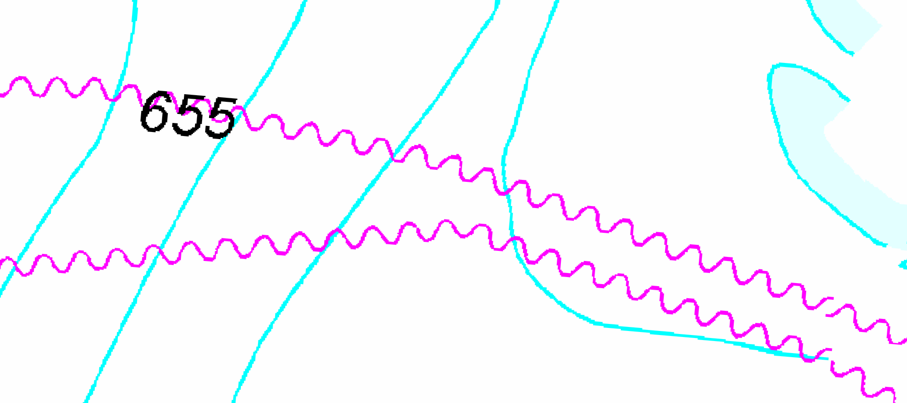
At present, there exists no publicly available vector geometry for the Svalbard subsea cables suitable for analysis: TeleGeography is imprecise [41], EMODnet Human Activities and OpenStreetMap are incomplete or offset [42] [43]. However, Kartverket supplies raster data for nautical charts and marine infrastructure via a Web Map Service (WMS) [11] [21].

The nautical charts are a mosaic of multiple different sheets at different scales. During the investigative process, a discrepancy was noticed between charts 505 and 507 [21]. The route shown on chart 505 is used because it agrees with Kartverket’s separate maritime-infrastructure kabel_l layer. The repair route in EFS notice 71611 follows the displaced route in chart 507 [19].

Using the maritime infrastructure WMS, the raster image can be vectorised programmatically. This process produces the connected cable geometry within the requested area. Any separate manually traced cable geometry is used only for visuals and is not part of cable_a.

The cable_a comes only from Kartverket’s kabel_l Web Map Service1 layer [44]. The extraction uses the bounding box of the EFS notice track, expanded by the maximum gear reach, and requests one image with 10 m pixels in EPSG:25833. The EFS track defines only the request area; the cable geometry comes from the WMS. The pipeline selects the largest connected group of rendered cable pixels and extracts its centreline.

Figure 9 Chart 505 and Chart 507 over the same EPSG:25833 viewport, with the raw EFS 71611 track and Kartverket's kabel_l WMS layer overlaid. Chart 507 and the notice track are displaced from the infrastructure layer; Chart 505 follows it more closely. Chart © Kartverket.
AIS and vessel path

The incident and Cable Vigilance AIS data are downloaded separately from the Kystdatahuset API [45]. For each download, the database preserves the original response, the request parameters, and a hash of the response. The API does not require credentials.

Request parameters:

RequestParameters
Incident
Returns all vessels inside the bounding box
{
  "bbox": "6,76,12,79",
  "start": "202201070240",
  "end": "202201070320",
  "minSpeed": 0
}
Cable Vigilance
Requested from 2023-06-23 13:00:00 to 2023-06-29 00:00:00
{
  "mmsiIds": [
    228416900
  ],
  "start": "202306231300",
  "end": "202306290000",
  "minSpeed": 0
}

The raw data can contain several reports from the same vessel at the same time. The model resolves these duplicates so that each dataset contains one position per vessel and timestamp. If a vessel reports the same coordinates repeatedly, the reports are reduced to one position at the midpoint of the interval. Speed over ground (SOG) and course over ground COG are used only as checks on the vessel’s movement. The pipeline rejects an AIS position only when the movement into and out of that position exceeds the permitted limit.

The reported failure interval is [2022-01-07 03:10:00, 2022-01-07 03:11:00) UTC. The model uses AIS positions from 02:40 to 03:20 and projects them into a local azimuthal equidistant coordinate system. It fits a two-dimensional cubic spline to the vessel track, with a 5 m RMS position allowance, to estimate the vessel’s position and direction at 1-second intervals.

Trawl gear geometry

The model represents the trawl gear as two doors and a centre clump moving behind the vessel.

Parameter Value Basis
Door spread (m) 120.0, 220.0, 320.0, 420.0, 520.0 Eigaard et al. report the relationship Door spread=9.6054×engine power0.4337\text{Door spread} = 9.6054 \times \text{engine power}^{0.4337} for the OT_DMF demersal-fish otter-trawl category [24, tbl. 4]. Applied to the reported Melkart-5 engine power of 3,235 kW, it gives approximately 320 m [14]. The tested values bracket this estimate.
Warp-to-depth ratio 2.0, 2.1, 2.2, 2.3, 2.4, 2.5, 3.0, 3.1, 3.2, 3.3, 3.4, 3.5, 3.6, 3.7, 3.8, 3.9, 4.0 A report from the Scottish Executive Rural Affairs Department establishes a typical range of warp/depth ratios from 2:1 to 4:1 [46, p. 3]

For each of the 85 unique parameter combinations, the model:

  1. Samples the fitted AIS track at 1-second intervals and moves each position 25 m aft along the track to obtain the towing-point path.

  2. Samples depth at each towing point and calculates:

    Warp length=Water depth×Warp-to-depth ratio\text{Warp length} = \text{Water depth} \times \text{Warp-to-depth ratio}

  3. Rejects a geometry case if the calculated warp exceeds 3,000 m or if the door spread cannot fit within the horizontal warp reach.

  4. Calculates the distance of the gear centre behind the towing point:

    Backward distance2=Warp length2−Water depth2−(Door spread2)2\text{Backward distance}^2 = \text{Warp length}^2 - \text{Water depth}^2 - \left(\frac{\text{Door spread}}{2}\right)^2

  5. Places the gear centre behind the current towing point. It places the doors at half the configured spread on opposite sides of the centre and places the centre clump at the centre.

  6. Checks that the three-dimensional distance from the towing point to each door equals the calculated warp length and that the distance between the doors equals the configured spread.

  7. Store the port-door, starboard-door, and centre-clump coordinates for each model interval and geometry case.

  8. Join each component’s consecutive positions into line segments during the analysis interval.

  9. Test each segment for an intersection with the cable_a. For each intersection, calculate the position, time, and distance along the cable, and record whether it occurred during the failure minute.

Model results
Warp-to-depth ratioDoor spread (m)
120220320420520
2.0—————
2.1—————
2.2—————
2.3—————
2.4—PortPortPortPort
2.5PortPortPortPortPort
3.0——StarboardStarboardStarboard
3.1———StarboardStarboard
3.2————Starboard
3.3—————
3.4—————
3.5—————
3.6—————
3.7—————
3.8—————
3.9—————
4.0—————
Port, Starboard and Clump identify the component-centre crossing produced by each geometry during the failure minute. An em dash means that the geometry produced no crossing.

Crossings are tested separately. Each component segment is clipped to the analysis interval and intersected with the cable centreline. Crossing time is interpolated along the segment, and crossings within the failure minute are marked for the results table.

Across the reported minute, 15 cases produce 15 component-centre crossings: 9 port-door, 6 starboard-door and 0 centre-clump crossings. These are sensitivity cases, not separate real interactions or probabilities.

Component Crossing cases
Port trawl door 9
Centre clump 0
Starboard trawl door 6
Limitations

This is a two-dimensional model. It estimates the horizontal positions of the trawl doors and centre clump. It does not model any forces or contact with the seabed or cable.

A deliberately simple model is used for this reconstruction. More advanced trawl gear models could represent the components physically and model the forces that act upon them. However, this is needlessly complex for the purposes of this investigation, which is purely to approximate the horizontal lag of the components. Placing the gear along the previous vessel track is not a realistic representation of a towed system, but is acceptable given the short window of analysis and simple motion of the trawler.

Extras

Repair location method

The repair location is estimated from two independent sources. First, EFS notice 71611 defines a 76 km repair segment [19]. However, the notice line follows the displaced cable position on Chart 507. The modelled incident centroid is therefore 824 m from the notice line.

Second, the analysis uses the AIS track of the repair ship Cable Vigilance [45]. It selects all positions at or below 0.5 knots and counts them in 100 m grid cells. The centres of the two cells with the most positions define the western and eastern working areas. The west working area is 249 m from the modelled incident centroid.

Vessel screen

The vessel screen tests all AIS positions during the failure minute. For each vessel, it calculates the shortest distance from its reported positions to cable A. It then compares this distance with a conservative maximum gear reach.

The reach limit is 3,285 m: a 3,000 m maximum warp length2, 260 m for half of the maximum door spread, and 25 m for the AIS antenna offset. Its purpose is only to exclude vessels that were clearly too far from the cable.

3 vessels were present in the AIS data during the failure minute. Only 1 vessel, the Melkart-5, was within the conservative reach limit. The screen therefore selects the Melkart-5 for detailed modelling; it does not show that its gear contacted the cable.

Yagry crossings

In order to determine when the Yagry crossed cable A, its AIS positions are requested for the day of the incident [45]. Each pair of consecutive AIS positions defines a straight line segment. Where a segment intersects the cable, the crossing time is estimated from the distance of that point along the segment. This method identifies 4 crossings between approximately 15:24:28 and 19:53:29 UTC.

ERS method

The Norwegian Directorate of Fisheries provides catch reports via its ERS Daily Catch Activity (DCA) messages dataset [18]. To filter for only reports from trawlers during the winter season in the area around the cable:

Field Value(s)
Relevant year
(Norwegian: Relevant år)
2020–2023
Start timestamp
(Norwegian: Starttidspunkt)
January–April
Start main area code
(Norwegian: Hovedområde start (kode))
25 (North-west Spitsbergen; Norwegian: Nordv.- Spitsbergen)
21 (West Spitsbergen; Norwegian: Vest-Spitsbergen)
Start location code
(Norwegian: Lokasjon start (kode))
25: 04, 05
21: 25, 26
Gear group
(Norwegian: Redskap - hovedgruppe)
Trawl
(Norwegian: Trål)

From this subset, the trawling configurations and main catch species can be identified:

FieldValueCount
Gear type
(Norwegian: Redskap FAO)
Bottom otter trawl
(Norwegian: Bunntrål, otter)
166
Gear configuration
(Norwegian: Redskapsspesifikasjon)
Double trawl
(Norwegian: Dobbeltrål)
158
Single trawl
(Norwegian: Enkeltrål)
2
More than triple trawl
(Norwegian: Mer enn trippel trål)
6
Main species
(Norwegian: Hovedart FAO)
Atlantic cod
(Norwegian: Torsk)
152
Haddock
(Norwegian: Hyse)
8
Northern shrimp
(Norwegian: Dypvannsreke)
6

Hashing

SHA-256 hashes pin the raw EFS XML, the GEBCO bathymetry values used by the model, and the WMS-derived cable_a geometry. A mismatch in any of these inputs stops reproduction. Each AIS response is also hashed, while a separate content hash covers the incident-vessel timestamps, coordinates, speeds, and courses used by the model. Finally, the scientific configuration and the core analysis code are hashed. These values are combined to produce the model run identifier, so a change to the AIS data, configuration, or implementation creates a distinct run.

Vessels

Vessel IMO MMSI
Melkart-5 [47] 9130183 273418680
Cable Vigilance [48] 9329930 228416900
Polarsyssel [49] 9690949 257564000
Yagry [50] 8953497 273550600

Data sources

Data source Use in the investigation Licence
Kystdatahuset Open API [45] Incident and Cable Vigilance AIS Norwegian Licence for Open Government Data (NLOD) 1.0
Kartverket kabel_l [11] Raster cable geometry CC BY 4.0.
GEBCO 2026 Grid [12] Depth used to estimate warp geometry and seabed slope Public domain with attribution
Global Fishing Watch apparent fishing effort [30] Historical trawling data CC BY-NC 4.0.
EFS notice 71611 [19] Cable repair location Public domain with attribution
Norwegian ERS open data [18] Regional fishing context NLOD.

Tech stack

Technology Purpose
Python 3.13 Acquires the source data, runs the model, and calculates the publication metrics.
DuckDB + spatial extension Stores source records, model results, and publication metrics.
NumPy and SciPy Fit the AIS track and carry out the numerical calculations.
Shapely, PyProj and Rasterio Handle vector geometry, coordinate transformations, and bathymetry sampling.
QGIS Used for exploratory geospacial analysis.

  1. A Web Map Service returns rendered map images for requested layers and bounding boxes, rather than direct vector geometry. The centreline used here is extracted deterministically from those rendered pixels. ↩︎

  2. ISO 6115 gives an upper bound of 3,000 m for demersal trawl winch capacity [51, tbl. 1, annex B]. ↩︎

Bibliography
  1. [1] Space Norway AS, “Bortfall av reservekapasitet på svalbardfiberen,” Oslo, Norway, Jan. 2022. [Online]. Available: https://web.archive.org/web/20220109095007/https://www.sysselmesteren.no/contentassets/8e497b11f18146029a022462c8dc09ca/pressemelding-fra-space-norway.pdf
  2. [2] T. Baardseth and A. Kvalbein, “Technical solution and implementation of the svalbard fiber cable,” 2004. [Online]. Available: https://web.archive.org/web/20120415123547/http://www.telektronikk.com/volumes/pdf/3.2004/Page_140-152.pdf
  3. [3] Statistics Norway, “07430: Norwegian settlements at Svalbard, by half year and settlement,” 2026. [Online]. Available: https://www.ssb.no/en/statbank/table/07430
  4. [4] Kommunal-og distriktsdepartementet, “Foreslår ny reserveløsning for digital kommunikasjon mellom svalbard og fastlandet.” [Online]. Available: https://www.regjeringen.no/no/aktuelt/foreslar-ny-reservelosning-for-digital-kommunikasjon-mellom-svalbard-og-fastlandet/id2906809/
  5. [5] G. Flaaten, “Kabelbruddet på svalbard: spor peker i retning av at mennesker står bak,” Bergens tidende, Feb. 10, 2022. [Online]. Available: https://www.bt.no/i/bGw6xA
  6. [6] B. M. Pettersen, I. Eriksen, and R. N. Andreassen, “Én russisk fisketråler har krysset svalbardfiberen mer enn 140 ganger,” NRK, Oct. 08, 2022. [Online]. Available: https://www.nrk.no/nordland/den-russiske-fisketraleren-_melkart-5_-krysset-svalbardfiberen-over-140-ganger-1.16128138
  7. [7] A. Staalesen, “‘Human activity’ behind Svalbard cable disruption,” The barents observer, Feb. 11, 2022. [Online]. Available: https://www.thebarentsobserver.com/security/human-activity-behind-svalbard-cable-disruption/160886
  8. [8] Troms politidistrikt, “Henlegger sak etter kabelbrudd til svalbard.” [Online]. Available: https://web.archive.org/web/20220321121007/https://www.politiet.no/aktuelt-tall-og-fakta/aktuelt/nyheter/2022/03/21/svalbard
  9. [9] G. Flaaten, “Russisk tråler passerte over internettkabelen mer enn 30 ganger. Så sluttet den å virke.,” E24, Mar. 14, 2022. [Online]. Available: https://e24.no/naeringsliv/i/G3bM5V/russisk-traaler-passerte-over-internettkabelen-mer-enn-30-ganger-saa-sluttet-den-aa-virke
  10. [10] B. Schuurman, “Russian Operations Against Europe Dataset,” Jan. 13, 2026. doi: 10.7910/DVN/TQ0FMQ.
  11. [11] “Sjøkart – maritim infrastruktur WMS,” 2024. [Online]. Available: https://kartkatalog.geonorge.no/metadata/sjoekart-maritim-infrastruktur-wms/f91314d8-d397-46d5-945a-27075f4210 Licence: CC BY 4.0
  12. [12] GEBCO Compilation Group, “GEBCO 2026,” 2026. doi: 10.5285/4f68d5c7-45eb-f999-e063-7086abc036fa. Licence: Public domain
  13. [13] Norwegian Maritime Authority, “KONGSFJORD - norwegian ordinary ship register.” [Online]. Available: https://skipssok.sdir.no/#/en/vessel?vesselId=56581&search=9130183&register=nisnor
  14. [14] Murman SeaFood, “Fleet | Murman SeaFood.” [Online]. Available: https://murmanseafood.ru/eng/flot/
  15. [15] O. K. Fostad, “Sanctions based on imaginary wrongdoings.” [Online]. Available: https://skyggekrigen.no/en/artikler/spiontraleren
  16. [16] Rock Trawl-doors, “Super Shark.” [Online]. Available: https://www.rock.fo/en-super-shark
  17. [17] Rock Trawl-doors, “Melkart 5 EX Kongsfjord.” [Online]. Available: https://www.rock.fo/single-post/2019/03/17/melkart-5-ex-kongsfjord-1
  18. [18] Fiskeridirektoratet, “Åpne data: elektronisk rapportering (ERS).” Accessed: Jun. 07, 2026. [Online]. Available: https://www.fiskeridir.no/statistikk-tall-og-analyse/data-og-statistikk-om-yrkesfiske/apne-data-elektronisk-rapportering-ers Licence: Norwegian Licence for Open Government Data (NLOD) 1.0
  19. [19] Norwegian Hydrographic Service, “71611. (T) grønlandshavet. Forlandsbanken. Prins karls forland SV. Kabelreparasjon,” Temporary Notice to Mariners, Jun. 2023. [Online]. Available: https://kartverket.no/efs-documents/editions/2023/efs11-2023.pdf
  20. [20] H. Gulldahl, “This is what the damaged Svalbard cable looked like when it came up from the depths.” [Online]. Available: https://www.nrk.no/tromsogfinnmark/this-is-what-the-damaged-svalbard-cable-looked-like-when-it-came-up-from-the-depths-1.16895904
  21. [21] “Sjøkart - raster WMS,” Nov. 18, 2019. [Online]. Available: https://kartkatalog.geonorge.no/metadata/sjoekart-raster-wms/3089e311-e933-47f7-bc62-ba42e58fa739
  22. [22] N. Grøvan, “Redundancy on primary telecom connection to Svalbard restored.” [Online]. Available: https://spacenorway.com/news/redundancy-on-primary-telecom-connection-to-svalbard-restored
  23. [23] M. Straumsnes, L. Pedersen, and R. N. Andreassen, “Kabelbruddet på svalbard forblir et mysterium – politiet henlegger saken,” NRK, Mar. 21, 2022. [Online]. Available: https://www.nrk.no/tromsogfinnmark/kabelbruddet-pa-svalbard-forblir-et-mysterium-_-politiet-henlegger-saken-1.15893095
  24. [24] O. R. Eigaard et al., “Estimating seabed pressure from demersal trawls, seines, and dredges based on gear design and dimensions,” 2016. doi: 10.1093/icesjms/fsv099.
  25. [25] P. G. Allan, “Performance of subsea mechanical trenching systems,” presented at the Proceedings of the 5th International Symposium on Frontiers in Offshore Geotechnics, Nantes, France, 2025. [Online]. Available: https://www.issmge.org/uploads/publications/132/133/ISFOG2025-353.pdf
  26. [26] J. I. Svendsen, A. Elverhoi, and J. Mangerud, “(Table 1) Age Determination of Sediment Core 90-21-GC1,” 1996. doi: 10.1594/PANGAEA.732364.
  27. [27] National Oceanic and Atmospheric Administration and Olympic Coast National Marine Sanctuary, “Environmental Assessment for the Pacific Crossing-1 North and East submarine fiber-optic cables in Olympic Coast National Marine Sanctuary,” Aug. 2018. [Online]. Available: https://nmssanctuaries.blob.core.windows.net/sanctuaries-prod/media/docs/submarine-cables-in-olympic-coast-nms.pdf
  28. [28] B. Sternal, W. Szczuciński, M. Forwick, M. Zajączkowski, S. Lorenc, and J. Przytarska, “Postglacial variability in near-bottom current speed on the continental shelf off south-west Spitsbergen,” 2014. doi: 10.1002/jqs.2748.
  29. [29] N. I. Doherty and J. A. Howe, “Echo character mapping and depositional processes on the western Svalbard continental margin,” 2025. doi: 10.33265/polar.v44.10847.
  30. [30] Global Fishing Watch, “AIS apparent fishing effort,” 2026. [Online]. Available: https://globalfishingwatch.org/dataset-and-code-fishing-effort/ Licence: CC BY-NC 4.0
  31. [31] S. Mcfarlane and G. Slattery, “NATO allies foil Russian subsea cable sabotage plot,” Reuters, Sep. 10, 2026. [Online]. Available: https://www.reuters.com/world/europe/nato-allies-foil-russian-subsea-cable-sabotage-plot-2026-09-10/
  32. [32] Nærings- og fiskeridepartementet, “Regjeringen vil etablere nytt sjøfibersamband til svalbard og jan mayen.” [Online]. Available: https://www.regjeringen.no/no/aktuelt/regjeringen-vil-etablere-nytt-sjofibersamband-til-svalbard-og-jan-mayen/id3087787/
  33. [33] Space Norway, “Annual Report 2023,” Annual report, Oct. 2024. [Online]. Available: https://spacenorway.com/wp-content/uploads/2024/10/Space-Norway_Annual_Report_2023.pdf
  34. [34] Wikipedia contributors, “Svalbard Satellite Station,” Wikipedia. Jul. 26, 2026. [Online]. Available: https://en.wikipedia.org/w/index.php?title=Svalbard_Satellite_Station&oldid=1366061047
  35. [35] B. J. Cannon, K. Matsuo, and M. Matsuda, “Mapping undersea cable risk from bathymetry to geopolitics: Evidence-based rankings and tailored resilience strategies,” Apr. 2026. doi: 10.1016/j.marpol.2025.107012.
  36. [36] C. Edwards and N. Seidenstein, “The Scale of Russian Sabotage Operations Against Europe’s Critical Infrastructure,” Aug. 2025. [Online]. Available: https://www.iiss.org/research-paper/2025/08/the-scale-of-russian--sabotage-operations--against-europes-critical--infrastructure/
  37. [37] A. S. Bowen, S. E. Garding, D. E. Mix, and C. A. Theohary, “Russian Hybrid Warfare Activities in Europe: Considerations for Congress,” Sep. 2026. [Online]. Available: https://www.congress.gov/crs-product/R49134
  38. [38] C. Freitas, E. M. Olsen, E. Moland, L. Ciannelli, and H. Knutsen, “Behavioral responses of Atlantic cod to sea temperature changes,” 2015. doi: 10.1002/ece3.1496.
  39. [39] FishBase, “Gadus morhua, Atlantic cod: fisheries, aquaculture, gamefish.” [Online]. Available: https://www.fishbase.se/summary/Gadus-morhua
  40. [40] FishBase, “Melanogrammus aeglefinus, Haddock: fisheries, aquaculture, gamefish.” [Online]. Available: https://www.fishbase.se/summary/Melanogrammus-aeglefinus
  41. [41] TeleGeography, “Svalbard Undersea Cable System.” [Online]. Available: https://www.submarinecablemap.com/submarine-cable/svalbard-undersea-cable-system
  42. [42] Cogea Srl, “EMODnet Human Activities, Cables, Telecommunication, Actual Routes,” Jun. 28, 2023. [Online]. Available: https://ows.emodnet-humanactivities.eu/geonetwork/srv/api/records/39ebe289-410b-4a5d-88a4-51bfcde538de Licence: CC BY 4.0.
  43. [43] “Svalbard Undersea Cable System‬ (way ‪685021407‬),” Mar. 21, 2025. [Online]. Available: https://www.openstreetmap.org/way/685021407
  44. [44] GeoNorge, “Sjøkart - maritim infrastruktur - kartkatalogen.” [Online]. Available: https://kartkatalog.geonorge.no/metadata/sjoekart-maritim-infrastruktur/a894ea02-d2dc-4550-ac3e-49230ceed42a
  45. [45] Norwegian Coastal Administration, “Kystdatahuset open API.” Accessed: Jul. 13, 2026. [Online]. Available: https://kystdatahuset.no/ws/swagger/index.html Licence: Norwegian Licence for Open Government Data (NLOD) 1.0
  46. [46] Scottish Executive Rural Affairs Department, “A Fishing Industry Guide to Offshore Operators,” 2001. [Online]. Available: https://www.iscpc.org/documents/?id=309
  47. [47] “MELKART 5.”
  48. [48] “CABLE VIGILANCE.” [Online]. Available: https://www.marinetraffic.com/is/ais/details/ships/shipid:386285
  49. [49] “POLARSYSSEL.” [Online]. Available: https://www.marinetraffic.com/en/ais/details/ships/shipid:307435/mmsi:257564000/imo:9690949/vessel:POLARSYSSEL
  50. [50] “YAGRY.” [Online]. Available: https://www.marinetraffic.com/en/ais/details/ships/shipid:351163/mmsi:273550600/imo:8953497/vessel:YAGRY
  51. [51] Shipbuilding — Trawl winches, Nov. 1988. [Online]. Available: https://www.iso.org/standard/12331.html